
The Digital Elevation Model (DEM) of the subglacial terrain of the Qiyi GlacierRecently,the"2024 Gansu Provincial Typical Glacier Aerial Ice Radar Perspective Detection Project,"undertaken by the Aerial Remote Sensing Center of the Aerospace Information Research Institute (AIR) under the Chinese Academy of Sciences,has successfully passed acceptance.
This project,part of the first batch of the 2024 Gansu Provincial Water Resources Basic Survey Projects,primarily utilized the MA60 remote sensing aircraft and Cessna Citation remote sensing aircraft from the national major science and technology infrastructure known as the"Chinese Aeronautic Remote Sensing System."Equipped withaerial ice radar (in both bathymetric and tomographic imaging modes) and 3D laser radar,theproject conducted perspective detection of glaciers. This marked China's first survey of typical glacier (including the Laohugou No. 12 Glacier, Qiyi Glacier, and Ningchanhe No. 3 Glacier) reserves using aerialiceradar technology. The work provides critical data support for water resource management and decision-making in various river basins of the Hexi Corridor, as well as for ecological protection of the Qilian Mountains and regional sustainable development.
The survey,conducted from September to November 2024, involved 13 effective flights, collecting 5.6TB ofraw data. The project achieved results such as digital elevation models (DEMs) of the glacier surface and bedrock beneath the glacier, glacier profiles, glacier reserves,3D perspective views of the glaciers, andreserves of the three typical glaciers. It also completed an accuracy evaluation of glacier thickness by combining ground-penetrating radar (GPR) measurement data, successfully fulfilling all project tasks.
The acceptance was organized by the Gansu Provincial Department of Natural Resources in Lanzhou. The expert panel highly praised the project,noting that it"achieved,for the first time,the measurement of ice thickness in complex valley glaciers under challenging terrain conditions,with overall technology reaching an internationally leading level."They recommended promoting the wider and better application of aerial ice radar technology in China's glacier resource surveys.
Aerial ice radar is a radar mounted on aircraft for perspective observation of glaciers. By emitting low-frequency electromagnetic waves,such as P-band or VHF-band,towards glaciers and receiving scattered echoes from the glacier surface and bedrock beneath,it processes and inverts the data to obtain information on glacier thickness and reserves. Compared with traditional technologies like aerial photography cameras,3D laser radars,and synthetic aperture radars,which are mainly used to acquire surface information of glaciers,aerial ice radar has the capability to penetrate the glacier surface and obtain internal and basal information.
The aerial ice radar technology was developed under the National Key Research and Development Program's"Aerial Collaborative Perspective Detection Technology System"project. It is an important component of the"Transparent Earth"multi-sphere perspective detection technology deployed in the"Earth Observation and Navigation"key special project and serves as a key piece of equipment supporting the construction of the"China Transparent Earth Airborne Prototype System."
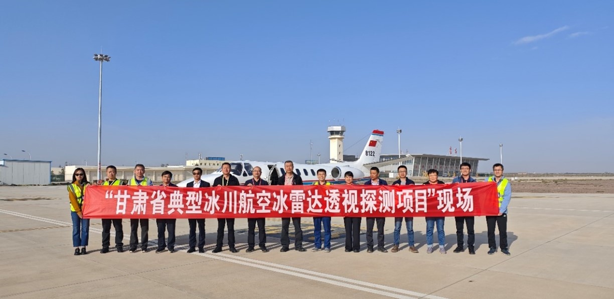
The Gansu Provincial Department of Natural Resources conducted on-site inspections and exchanges regarding project work.
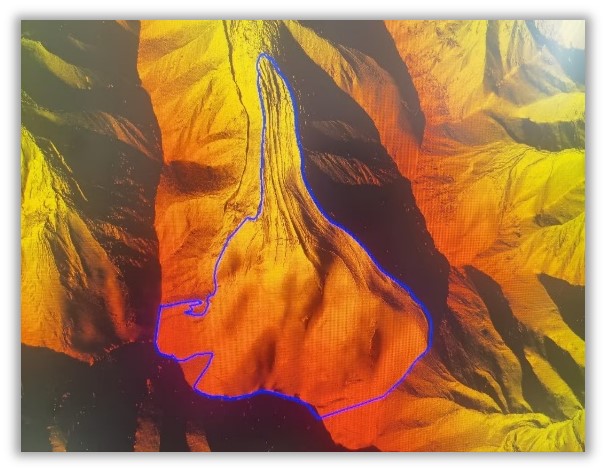
Digital Elevation Model (DEM) of the Qiyi Glacier Surface
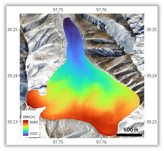
The Digital Elevation Model (DEM) of the subglacial terrain of the Qiyi Glacier
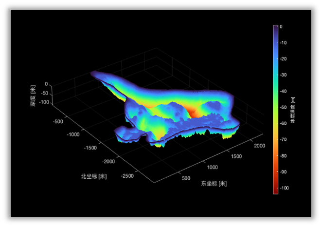
The 3D perspective view of the Qiyi Glacier
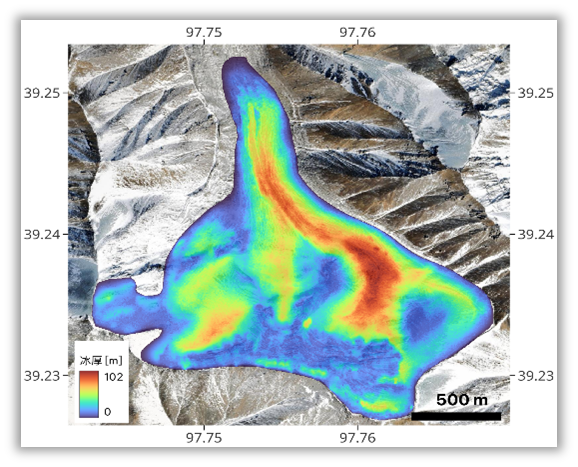
Glacier thickness distribution map of the Qiyi Glacier
