- Facilities at a Glance
- All Facilities
- Material
- Earth System and Environment
- Engineering Technology
- Space and Astronomy
- Particle and Nuclear Physics
- Energy
- Biology


- 1
- 2
- 3

Institute of Remote Sensing and Digital Earth,CAS
Contact: Ms.Xu
Phone: +86 010-82178733
Email: xulq@aircas.ac.cn
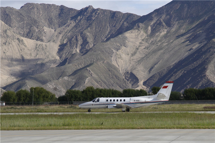
Remote Sensing Aircraft (RSA)
Two Citation S/II Remote Sensing Aircraft (hereafter referred to as RSA) of Chinese Academy of Sciences(CAS), are minitype business aircraft produced by Cessna Aircraft Company on 1986 and modified for multiple scientific applications. With solid contributions made to aeronautic and astronautic earth observation progress in China, they are still one of the few irreplaceable high-performance experiment platforms in China with their overall technological advantages keeping a leading position. Catered for customized services to central and ministerial missions, key S&T projects, and demand from international, local, social and college cooperation, RSA have adhered to non-profitable flight and data sharing, provided A-level operation for aerial flight tests, and carried out airborne remote sensing experiments with varied optical, infrared, microwave and atmospheric sensors. In organization, RSA have stayed under the administration of Institute of Remote Sensing & Digital Earth, CAS. Together with Satellite Ground Station (another National Scientific Key Infrastructure of RADI) and Digital Earth Scientific Platform, RSA constitutes an integrated Satellite-Aircraft-Ground Simultaneous Earth Observation system.
Since put into operation, RSA has conducted more than 10000 sorties made its white wings seen over the vast land of China, including Pamir Mountains to the west, Heihe Basin in the east, Altai Mountains and Mohe to the North, and even China South Sea, covering an area of two million square kilometers of all provinces, autonomous regions, municipalities, HK SAR, except for Taiwan and Macau.
It is our founding principle that science, remote sensing, can make this country a better place. And for more than 3 decades, we have. At the same time, we have always understood that fidelity to our founding principles requires new responses to new challenges. In future, we will keep improving our strength and be a critical RS data & research center, keep working as an advanced RS info-tech platform, and keep providing data support for space technology development, emergency, environment and disaster monitoring as national aviation strength.
Equipment
-

The ADS80 airborne digital aerial photogrammetry system
The ADS80 is a push-broom airborne digital aerial photogrammetry system which integrates a high-precision inertial navigation orientation system and a global satellite positioning system. It uses a 12,000-pixel three-line array CCD scan and an advanced single-aperture focal length lens. One flight can simultaneously acquire three-fold overlapping of front view, bottom point and rear view, continuous seamless full-color stereo image, color images, and color infrared images.
-
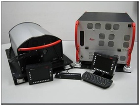
The ALS70 airborne laser scanning system
The ALS70 airborne laser scanning system is composed of a system controller, a laser controller, a camera controller, a laser scanner, an operation terminal, and a navigation terminal. The system is built on the principle of laser ranging. The laser pulse is emitted by the scanner. The echo signal of the received pulse is then recorded by the laser controller. The time interval between transmission and reception is combined with the laser scanning parameters to calculate the 3D coordinates of ground objects. Its maximum pulse frequency is 250 kHz and its maximum sweep frequency is 100 Hz.
-

POS
POS系统(position and orientation system),定位定向系统,是利用GPS和IMU组合解算求得传感器数据获取时刻的位置和姿态信息,变传统的地面控制为空中控制,减少了地面控制点,可配合模拟传感器和数字传感器集成使用,提高了数据获取效率,缩短了成图周期。
-
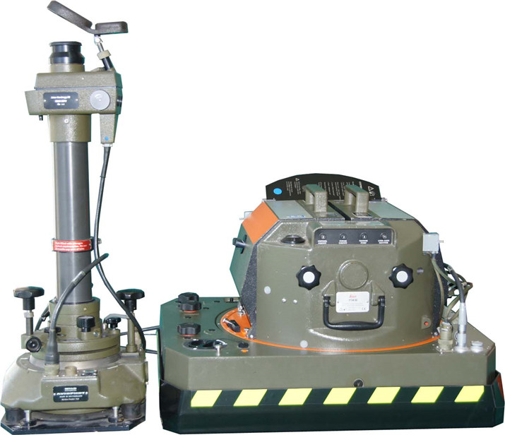
RC30光学相机
RC30航空相机可使用黑白、彩色、彩红外、红外等胶卷进行摄影。
-
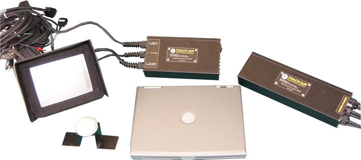
TRACK’AIR传感器控制与导航系统
TRACK’AIR传感器控制与导航系统在Microsoft Windows的普通PC或笔记本计算机操作下工作,由软硬件部分组合而成。其软件部分由6个Windows应用程序组成。每一组程序覆盖其中一项现代航空测量摄影任务:数字化,计划,数据采集,报告和存档。所有程序自动由普通Microsoft ACCESS的相关数据库连接在一起并能由不同的人在几台计算机上独立使用。硬件部分由外部相机接口控制盒(内置GPS),笔记本电脑,驾驶员显示器,视频转换控制盒组成。
-
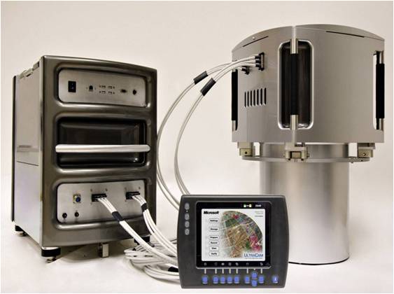
The UCXp area array digital aerial camera system
The UCXp area array digital aerial camera system is one of the most advanced ultra-large format digital aerial photography camera system. Its lens unit consists of 8 high-resolution optical lenses, of which 4 full-color band lenses are aligned in flight direction at equal intervals.
-
The Remote-sensing aircraft (modified with optical windows)
One remote-sensing aircraft (modified with optical windows) has two pressurized capsules and an unpressurized one in the back which support a common range of optical sensors made in China and abroad. Its comprehensive technical edge still plays a leading role in China.
-

The Remote-sensing aircraft (modified with radome)
Another remote-sensing aircraft (modified with radome) can carry a multi-band SAR and has the capacity of triple-antenna INSAR full polarimetric SAR imaging. With a camera window modified, it can also perform aerial photography despite severe weather conditions at all time round.
NOTICE
-
Call for Proposals for HEPS Phase II Beamlines May 23,2022